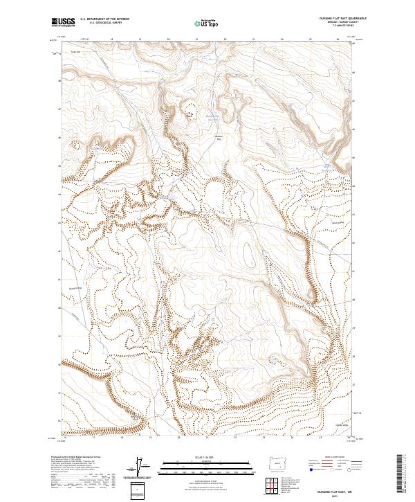
2023 Map of Duhaime Flat East
USGS Topo · Published 2023About this map
Duhaime Flat and the surrounding high-desert terrain of Harney County are defined by a network of expansive basins and sparse water management features. The landscape transition from Tucke Flat in the northwest down to the edge of Catlow Valley in the southeast highlights the importance of localized catchments like Meadow Flat Reservoir and Macs Reservoir. These small reservoirs were essential for supporting livestock in an arid region where geography is dictated by named terrain features such as Desert Field and the distinct overlook at Rock Creek Point. Remote roads like Clover Swail Rd and Duhaime Rd provide the primary human imprint, winding through the vast open spaces of Meadow Flat and Sand Hollow.
Find a feature on this map
15 named features on this map. Tap any name to fly to it.
Don’t see what you’re looking for? This feature index may not catch every label — zoom into the map to look around manually.
Map Details
Editions of this 2023 Duhaime Flat East Map
This is the sole edition of this map. No revisions or reprints were ever made.
Other maps of this area

1955 · Adel
USGS Topo · 1:250,000

1957 · Adel
USGS Topo · 1:250,000

1958 · Adel
USGS Topo · 1:250,000

1962 · Adel
USGS Topo · 1:250,000

1971 · Duhaime Flat East
USGS Topo · 1:24,000

1971 · Clover Swale
USGS Topo · 1:24,000
1971 · Keg Sprs Valley East
USGS Topo · 1:24,000

1971 · Butler Hill
USGS Topo · 1:24,000
1971 · Duhaime Flat West
USGS Topo · 1:24,000
1971 · Keg Sprs Valley West
USGS Topo · 1:24,000