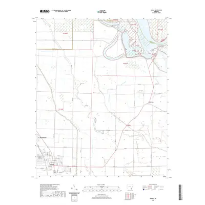
2020 Map of Dumas
USGS Topo · Published 2020About this map
The Arkansas River corridor defines the landscape of this Desha County region, where the river's winding course has left behind a complex network of oxbows and wetlands including Silver Lake and Echubby Lake. The city of Dumas sits in the southwestern corner, showing a detailed grid of streets such as Red Line Rd and Pickens St that serve as a local hub for the surrounding agricultural Delta. Small settlements like Mitchellville and the landing at Pendleton are connected by a system of levees and state routes. This survey highlights the intricate drainage of the basin, dominated by the meandering paths of Oakwood Bayou and Oak Log Bayou. For those tracing local families, the presence of Leach Cem and Jerusalem Cem provides specific points of interest amidst the expansive fields and brakes.
Find a feature on this map
53 named features on this map. Tap any name to fly to it.
Don’t see what you’re looking for? This feature index may not catch every label — zoom into the map to look around manually.
Map Details
Editions of this 2020 Dumas Map
This is the sole edition of this map. No revisions or reprints were ever made.
Other maps of this area

1935 · Varner
USGS Topo · 1:62,500

1935 · Rotan
USGS Topo · 1:62,500

1935 · Red Fork
USGS Topo · 1:62,500

1935 · Gillett
USGS Topo · 1:62,500

1948 · Helena
USGS Topo · 1:250,000

1950 · Helena
USGS Topo · 1:250,000

1953 · Greenwood
USGS Topo · 1:250,000

1955 · Helena
USGS Topo · 1:250,000

1956 · Greenwood
USGS Topo · 1:250,000

1959 · Helena
USGS Topo · 1:250,000