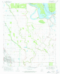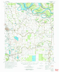
1971 Map of Dumas
USGS Topo · Published 1971About this map
The Arkansas River dictates the landscape of this delta region, where the Morgan Point Cut-Off (1966) reveals the ongoing engineering efforts of the U.S. Army Corps of Engineers. Settlement patterns follow the high ground and the corridor of the Missouri Pacific railroad, connecting towns like Dumas and Mitchellville with the smaller outposts of Pickens and Winchester. The agricultural character of Desha County is evident in the sprawling network of drainage features, including Canal No. 43 and Canal No. 81, alongside the Agricultural Experimental Station and numerous fish farms.
Find a feature on this map
78 named features on this map. Tap any name to fly to it.
Don’t see what you’re looking for? This feature index may not catch every label — zoom into the map to look around manually.
Map Details
Editions of this 1971 Dumas Map
This is the sole edition of this map. No revisions or reprints were ever made.
Historical Maps of Dumas Through Time
8 maps found