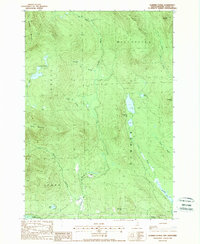
1988 Map of Dummer Ponds
USGS Topo · Published 1988About this map
Paris is the primary named community in this portion of Coos County, located along the winding course of Brooks Brook as it flows toward the Upper Ammonoosuc R. The landscape is dominated by significant elevation changes, from the heights of Whitcomb Mountain and Long Mountain to the low-lying waters of Dummer Ponds. This 1988 provisional survey details a remote, heavily forested region where the borders of Millsfield, Odell, Dummer, and Stark meet.
Find a feature on this map
25 named features on this map. Tap any name to fly to it.
Don’t see what you’re looking for? This feature index may not catch every label — zoom into the map to look around manually.
Map Details
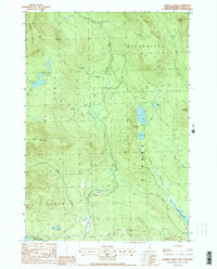
Editions of this 1988 Dummer Ponds Map
2 editions found
Other maps of this area

1930 · Milan
USGS Topo · 1:62,500

1930 · Percy
USGS Topo · 1:62,500

1930 · Dixville
USGS Topo · 1:62,500

1930 · Errol
USGS Topo · 1:62,500

1933 · Dixville
USGS Topo · 1:62,500

1933 · Milan
USGS Topo · 1:62,500

1934 · Percy
USGS Topo · 1:62,500

1934 · Dixville
USGS Topo · 1:62,500

1934 · Errol
USGS Topo · 1:62,500

1934 · Milan
USGS Topo · 1:62,500