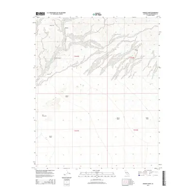
2015 Map of Dumont Dunes
USGS Topo · Published 2015About this map
Dumont Dunes and the Valjean Dunes dominate the southern portion of this landscape, where wind-shaped sands meet the wide expanse of the Silurian Valley. The geography of this corner of the Mojave Desert is defined by sharp elevation shifts between the Sperry Hills and the deep cut of Amargosa Canyon in the north. This 2015 survey illustrates a land largely untouched by modern development, characterized instead by traditional land divisions like t19n r7e and the single access provided by Dumont Dunes Rd. Researchers can identify specific landforms such as the Salt Spring Hills and the Dumont Hills, which provide essential reference points in an area defined by shifting desert topography and the corridor leading toward Sperry.
Find a feature on this map
14 named features on this map. Tap any name to fly to it.
Don’t see what you’re looking for? This feature index may not catch every label — zoom into the map to look around manually.
Map Details
Editions of this 2015 Dumont Dunes Map
This is the sole edition of this map. No revisions or reprints were ever made.
Other maps of this area

1933 · Avawatz Mountains
USGS Topo · 1:250,000

1947 · Trona
USGS Topo · 1:250,000

1948 · Trona
USGS Topo · 1:250,000

1948 · Avawatz Pass
USGS Topo · 1:62,500

1950 · Tecopa
USGS Topo · 1:62,500

1951 · Avawatz Pass
USGS Topo · 1:62,500

1951 · Tecopa
USGS Topo · 1:62,500

1951 · Shoshone
USGS Topo · 1:62,500

1953 · Trona
USGS Topo · 1:250,000

1956 · Silurian Hills
USGS Topo · 1:62,500