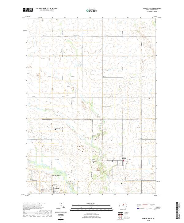
2022 Map of Dumont North
USGS Topo · Published 2022About this map
The West Fork Cedar River meanders across the southern landscape of Butler County, defining the agricultural character of this northern Iowa region. Near the river's bend, the town of Dumont serves as a local hub, with its grid of streets including W Broadway St and 2nd St situated near the Dumont Cem. The map reveals a high density of small rural burial grounds, such as Needham Cem and Oak Hill Cem, which offer significant value for genealogists tracing the early settlement patterns of the surrounding townships. To the east, Bristow is another focal point of activity, flanked by the Old Bristow Cem and South Bristow Cem. The terrain is further etched by numerous waterways like Boylan Cr and Parmentar Cr, which feed into the primary river system amidst a strictly organized section-line road network.
Find a feature on this map
49 named features on this map. Tap any name to fly to it.
Don’t see what you’re looking for? This feature index may not catch every label — zoom into the map to look around manually.
Map Details
Editions of this 2022 Dumont North Map
This is the sole edition of this map. No revisions or reprints were ever made.
Other maps of this area

1954 · Waterloo
USGS Topo · 1:250,000

1955 · Waterloo
USGS Topo · 1:250,000

1972 · Dumont North
USGS Topo · 1:24,000

1972 · Hansell
USGS Topo · 1:24,000
1972 · Dougherty
USGS Topo · 1:24,000
1972 · Aureola
USGS Topo · 1:24,000

1972 · Allison
USGS Topo · 1:24,000
1972 · Greene
USGS Topo · 1:24,000

1979 · Ackley NE
USGS Topo · 1:24,000

1979 · Dumont South
USGS Topo · 1:24,000