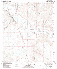
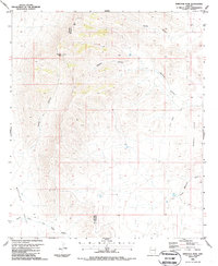
1986 Map of Duncan
USGS Topo · Published 1987About this map
The Gila River valley near the Arizona-New Mexico border defines this mid-1980s landscape, where irrigation networks and transportation corridors converge. The Duncan townsite is the primary hub, supported by the Southern Pacific Railroad and a local economy evidenced by a Cotton Gin and several gravel pits. To the southeast, the small settlements of Franklin and Virden lie amidst a complex system of water management, including the Sunset Canal, New Model Canal, and Valley Canal. The terrain transitions from the low-lying river flats to the high ground of Pearson Mesa, with numerous canyons like Blackfield Canyon and Carlisle Canyon cutting through the arid landscape. This mapping captures the region's agricultural infrastructure and social centers, such as the Fairground and multiple Athletic Fields, just years before major shifts in western rail operations.
Find a feature on this map
31 named features on this map. Tap any name to fly to it.
Don’t see what you’re looking for? This feature index may not catch every label — zoom into the map to look around manually.
Map Details
Editions of this 1986 Duncan Map
2 editions found
Other maps of this area

1954 · Silver City
USGS Topo · 1:250,000

1958 · Silver City
USGS Topo · 1:250,000

1959 · Steeple Rock
USGS Topo · 1:62,500

1959 · Canador Peak
USGS Topo · 1:62,500

1959 · York Valley
USGS Topo · 1:62,500

1960 · Duncan
USGS Topo · 1:62,500

1962 · Silver City
USGS Topo · 1:250,000
1986 · Sheldon
USGS Topo · 1:24,000
1986 · Hot Well
USGS Topo · 1:24,000
1986 · Whitlock Peak
USGS Topo · 1:24,000