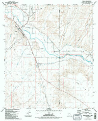
1986 Map of Duncan
USGS Topo · Published 1987About this map
The Gila River valley serves as the central corridor for agriculture and transportation along the Arizona-New Mexico border in the mid-1980s. The settlement of Duncan acts as a local hub, featuring a Fairground, multiple Athletic Fields, and a Cotton Gin that points to the region's agricultural economy. This irrigation-dependent landscape is defined by an intricate system of waterways, including the Valley Canal, Sunset Canal, and Model Canal, which divert water to the fields of Hunter Flat and the surrounding basin.
Find a feature on this map
32 named features on this map. Tap any name to fly to it.
Don’t see what you’re looking for? This feature index may not catch every label — zoom into the map to look around manually.
Map Details
Editions of this 1986 Duncan Map
2 editions found
Other maps of this area

1954 · Silver City
USGS Topo · 1:250,000

1958 · Silver City
USGS Topo · 1:250,000

1959 · Steeple Rock
USGS Topo · 1:62,500

1959 · Canador Peak
USGS Topo · 1:62,500

1959 · York Valley
USGS Topo · 1:62,500

1960 · Duncan
USGS Topo · 1:62,500

1962 · Silver City
USGS Topo · 1:250,000
1986 · Sheldon
USGS Topo · 1:24,000
1986 · Duncan
USGS Topo · 1:24,000
1986 · Hot Well
USGS Topo · 1:24,000