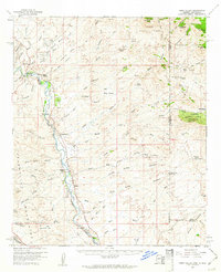
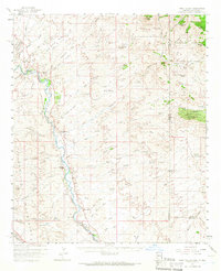
1959 Map of York Valley
USGS Topo · Published 1961About this map
The Gila River corridor serves as the primary artery for settlement and transport through this arid landscape on the Arizona-New Mexico border. The Southern Pacific railroad follows the river's western bank, connecting the small communities of York and Sheldon. These settlements are supported by local agriculture via the Monero Canal and established ranching outposts such as Hoverrocker Ranch and McKeon Ranch.
Find a feature on this map
96 named features on this map. Tap any name to fly to it.
Don’t see what you’re looking for? This feature index may not catch every label — zoom into the map to look around manually.
Map Details
Editions of this 1959 York Valley Map
3 editions found

Other maps of this area
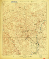
1902 · Clifton
USGS Topo · 1:62,500

1910 · Mogollon
USGS Topo · 1:125,000

1912 · Mogollon
USGS Topo · 1:125,000

1913 · Morenci
USGS Topo · 1:125,000

1915 · Morenci
USGS Topo · 1:125,000

1954 · Silver City
USGS Topo · 1:250,000

1954 · Clifton
USGS Topo · 1:250,000

1957 · Clifton
USGS Topo · 1:250,000

1958 · Silver City
USGS Topo · 1:250,000

1958 · Clifton
USGS Topo · 1:250,000