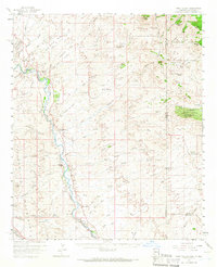
1959 Map of York Valley
USGS Topo · Published 1966About this map
The Gila River snakes through the western portion of this 1959 survey, carving out the fertile York Valley and providing a corridor for the Southern Pacific railroad. This area of eastern Arizona is defined by a sparse but established ranching landscape, where family-named outposts like the Davis Ranch, Willis Ranch, and Stevens Ranch are scattered across a complex network of dry washes and deep canyons. The settlement at Three Way serves as a local hub near the Greenlee County Airport, which, notably for the era, sits adjacent to a Drive-in Theater. To the east, the terrain rises sharply toward the Summit Mts and Big Mesa, marking the rugged transition toward the New Mexico border. The presence of the Twin Peaks Mine and numerous irrigation features like the Canal near Apache Grove reflects the dual economy of mineral extraction and river-bottom agriculture that sustained these borderland communities in the mid-20th century.
Find a feature on this map
93 named features on this map. Tap any name to fly to it.
Don’t see what you’re looking for? This feature index may not catch every label — zoom into the map to look around manually.
Map Details
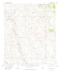
Editions of this 1959 York Valley Map
3 editions found

Other maps of this area

1902 · Clifton
USGS Topo · 1:62,500

1910 · Mogollon
USGS Topo · 1:125,000

1912 · Mogollon
USGS Topo · 1:125,000

1913 · Morenci
USGS Topo · 1:125,000

1915 · Morenci
USGS Topo · 1:125,000

1954 · Silver City
USGS Topo · 1:250,000

1954 · Clifton
USGS Topo · 1:250,000

1957 · Clifton
USGS Topo · 1:250,000

1958 · Silver City
USGS Topo · 1:250,000

1958 · Clifton
USGS Topo · 1:250,000