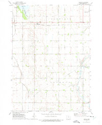
1972 Map of Duncan
USGS Topo · Published 1975About this map
The small settlement of Duncan serves as a focal point in this portion of north-central Iowa, situated along the Chicago Milwaukee St Paul and Pacific railroad line. The landscape reflects a highly managed agricultural environment, characterized by the presence of Drainage Ditch No 6 and numerous marshy pockets surrounding the West Branch and East Branch Iowa River. These watercourses meander through the townships of Garfield and Liberty, revealing the intricate hydrologic engineering required to support the region's farming heritage.
Find a feature on this map
17 named features on this map. Tap any name to fly to it.
Don’t see what you’re looking for? This feature index may not catch every label — zoom into the map to look around manually.
Map Details
Editions of this 1972 Duncan Map
This is the sole edition of this map. No revisions or reprints were ever made.
Other maps of this area

1954 · Mason City
USGS Topo · 1:250,000

1954 · Waterloo
USGS Topo · 1:250,000

1955 · Waterloo
USGS Topo · 1:250,000

1957 · Mason City
USGS Topo · 1:250,000

1958 · Mason City
USGS Topo · 1:250,000

1972 · Kanawha
USGS Topo · 1:24,000

1972 · Hayfield
USGS Topo · 1:24,000

1972 · Olaf
USGS Topo · 1:24,000

1972 · Crystal Lake
USGS Topo · 1:24,000
1972 · Miller
USGS Topo · 1:24,000