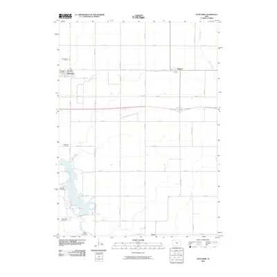
2010 Map of Duncombe
USGS Topo · Published 2010About this map
The town of Duncombe and the surrounding prairie landscape of Webster County are defined by a grid of agricultural section roads and several winding watercourses. Settlement is clustered around the Duncombe Post Office and the smaller community of Highview, while the southern reaches of the quadrangle transition into the recreation area surrounding Brushy Creek Campground. This 2010 survey provides a valuable resource for genealogists, as it documents several historic burial grounds across the township, including Saint Josephs Cemetery near the northern border, Washington Cemetery, Blanchard Cemetery, and the Ober and Scott Cemetery further south. The drainage patterns of Brushy Creek, Prairie Creek, and Brewers Creek break the rectilinear field patterns, indicating the natural topography that shaped early land claims and road placements like Stagecoach Rd.
Find a feature on this map
32 named features on this map. Tap any name to fly to it.
Don’t see what you’re looking for? This feature index may not catch every label — zoom into the map to look around manually.
Map Details
Editions of this 2010 Duncombe Map
This is the sole edition of this map. No revisions or reprints were ever made.
Other maps of this area

1923 · Lehigh
USGS Topo · 1:62,500

1923 · Fort Dodge
USGS Topo · 1:62,500

1954 · Waterloo
USGS Topo · 1:250,000

1954 · Fort Dodge
USGS Topo · 1:250,000

1955 · Waterloo
USGS Topo · 1:250,000

1957 · Fort Dodge
USGS Topo · 1:250,000

1958 · Fort Dodge
USGS Topo · 1:250,000

1965 · Lehigh
USGS Topo · 1:24,000

1965 · Evanston
USGS Topo · 1:24,000

1978 · Woolstock
USGS Topo · 1:24,000