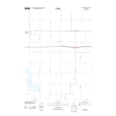
2013 Map of Duncombe
USGS Topo · Published 2013About this map
Duncombe and the neighboring settlement of Highview anchor this agricultural landscape in Webster County, where the transition between the rolling prairie and modern infrastructure is clearly defined. The area is marked by a systematic grid of section roads, including historically named routes such as Bach Grove Rd and Stage Coach Rd. To the south, the terrain shifts towards the recreation-focused lands surrounding Brushy Creek Lake, a significant water body bordered by the Brushy Creek Campground. This 2013 survey illustrates the convergence of traditional rural life with natural preservation, shown through the drainage patterns of Brewers Cr and Prairie Cr as they cut through the strictly partitioned farmland. The proximity of Highview to the primary east-west transportation corridor highlights the settlement patterns that historically supported the regional grain and rail economy.
Find a feature on this map
34 named features on this map. Tap any name to fly to it.
Don’t see what you’re looking for? This feature index may not catch every label — zoom into the map to look around manually.
Map Details
Editions of this 2013 Duncombe Map
This is the sole edition of this map. No revisions or reprints were ever made.
Other maps of this area

1923 · Lehigh
USGS Topo · 1:62,500

1923 · Fort Dodge
USGS Topo · 1:62,500

1954 · Waterloo
USGS Topo · 1:250,000

1954 · Fort Dodge
USGS Topo · 1:250,000

1955 · Waterloo
USGS Topo · 1:250,000

1957 · Fort Dodge
USGS Topo · 1:250,000

1958 · Fort Dodge
USGS Topo · 1:250,000

1965 · Lehigh
USGS Topo · 1:24,000

1965 · Evanston
USGS Topo · 1:24,000

1978 · Woolstock
USGS Topo · 1:24,000