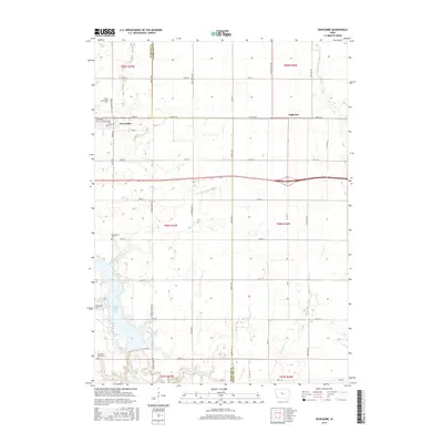
2015 Map of Duncombe
USGS Topo · Published 2015About this map
Duncombe serves as the primary settlement on this North Central Iowa landscape, situated along the county line where Webster and Hamilton counties meet. The area is defined by its deep agricultural grid and the natural drainage of Brewers Creek and Prairie Creek. To the east, the small elevator siding of Highview sits along the rail corridor, while the southwestern corner of the sheet is dominated by the waters of Brushy Creek Lake. Genealogists will find several burial sites scattered throughout the township sections, including Saint Josephs Cemetery just north of town, two separate locations labeled Washington Cemetery, and the Ober and Scott Cemetery near the southern boundary. These cemeteries, alongside local landmarks like Stagecoach Road, provide concrete points of interest for those tracing family roots through the rural townships of t89n r27w and t88n r27w.
Find a feature on this map
45 named features on this map. Tap any name to fly to it.
Don’t see what you’re looking for? This feature index may not catch every label — zoom into the map to look around manually.
Map Details
Editions of this 2015 Duncombe Map
This is the sole edition of this map. No revisions or reprints were ever made.
Other maps of this area

1923 · Lehigh
USGS Topo · 1:62,500

1923 · Fort Dodge
USGS Topo · 1:62,500

1954 · Waterloo
USGS Topo · 1:250,000

1954 · Fort Dodge
USGS Topo · 1:250,000

1955 · Waterloo
USGS Topo · 1:250,000

1957 · Fort Dodge
USGS Topo · 1:250,000

1958 · Fort Dodge
USGS Topo · 1:250,000

1965 · Lehigh
USGS Topo · 1:24,000

1965 · Evanston
USGS Topo · 1:24,000

1978 · Woolstock
USGS Topo · 1:24,000