
1932 Map of Dundee
USGS Topo · Published 1932About this map
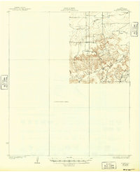
The confluence of the Little Wichita River and its North Fork defines this 1932 preliminary study of Archer County, Texas. This map provides a look at the landscape just before large-scale water management projects altered the regional drainage. The rural character of the area is highlighted by the Black Flat Sch, a local school serving the farming families of the high ground between the river and Holliday Creek. While the southeastern portion is densely mapped with contour lines and drainage patterns like Kickapoo Creek, the western half remains a Preliminary Edition Unsurveyed Area, reflecting the ongoing work of the State of Texas Board of Water Engineers during the early 1930s. The primary artery connecting the region is the Archer City Dundee Road, which cuts across the prairie to link the local ranching and agricultural interests.
Find a feature on this map
8 named features on this map. Tap any name to fly to it.
Don’t see what you’re looking for? This feature index may not catch every label — zoom into the map to look around manually.
Map Details
Editions of this 1932 Dundee Map
2 editions found
Other maps of this area

1931 · Archer City
USGS Topo · 1:62,500

1954 · Wichita Falls
USGS Topo · 1:250,000

1957 · Wichita Falls West
USGS Topo · 1:62,500

1958 · Wichita Falls
USGS Topo · 1:250,000

1963 · Dundee
USGS Topo · 1:24,000

1963 · Dundee SW
USGS Topo · 1:24,000

1963 · Megargel
USGS Topo · 1:24,000

1964 · Bobcat Bluff
USGS Topo · 1:24,000

1964 · Dundee SE
USGS Topo · 1:24,000

1964 · Archer City West
USGS Topo · 1:24,000