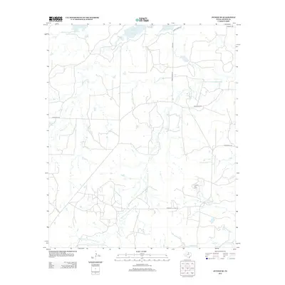
2012 Map of Dundee SE
USGS Topo · Published 2012About this map
Lake Kickapoo and its surrounding watershed dominate this North Texas landscape, where the Middle Fork Little Wichita River and tributaries like Kickapoo Cr shape the local drainage. The map reveals a region defined by ranching and resource extraction, notably marked by the presence of the Oldham Oil Field in the southeastern quadrant. This 2012 survey illustrates the network of rural infrastructure, including Ranch Road 210 and several secondary routes such as Farmer Rd and Wolf Rd that connect isolated properties. A poignant local landmark, Babies Graves Rd, suggests the deep-seated family histories and local lore etched into the Archer County countryside. The terrain remains largely open, with smaller water features like Parkey Lake and Brier Cr punctuating the expanses between the larger river systems.
Find a feature on this map
15 named features on this map. Tap any name to fly to it.
Don’t see what you’re looking for? This feature index may not catch every label — zoom into the map to look around manually.
Map Details
Editions of this 2012 Dundee SE Map
This is the sole edition of this map. No revisions or reprints were ever made.
Other maps of this area

1931 · Archer City
USGS Topo · 1:62,500

1932 · Dundee
USGS Topo · 1:62,500

1954 · Wichita Falls
USGS Topo · 1:250,000

1958 · Wichita Falls
USGS Topo · 1:250,000

1963 · Dundee
USGS Topo · 1:24,000

1963 · Dundee SW
USGS Topo · 1:24,000

1963 · Megargel
USGS Topo · 1:24,000

1964 · Bobcat Bluff
USGS Topo · 1:24,000

1964 · Dundee SE
USGS Topo · 1:24,000

1964 · Archer City West
USGS Topo · 1:24,000