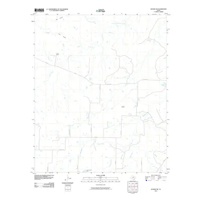
2010 Map of Dundee SW
USGS Topo · Published 2010About this map
The North Fork Little Wichita River and its many tributaries, including Godwin Creek and Kickapoo Creek, define the landscape of this Baylor County region. Cattle ranching and water management are evident in landmarks like the Boone Ranch and the Hrncirik Lake Dam. The terrain is marked by distinct drainage features such as Wolf Hollow and Red Hollow, which feed into the wider river system.
Find a feature on this map
25 named features on this map. Tap any name to fly to it.
Don’t see what you’re looking for? This feature index may not catch every label — zoom into the map to look around manually.
Map Details
Editions of this 2010 Dundee SW Map
This is the sole edition of this map. No revisions or reprints were ever made.
Other maps of this area

1932 · Dundee
USGS Topo · 1:62,500

1954 · Wichita Falls
USGS Topo · 1:250,000

1958 · Wichita Falls
USGS Topo · 1:250,000

1963 · Dundee
USGS Topo · 1:24,000

1963 · Dundee SW
USGS Topo · 1:24,000

1963 · Megargel
USGS Topo · 1:24,000

1964 · Dundee SE
USGS Topo · 1:24,000
1964 · Lake Olney
USGS Topo · 1:24,000

1966 · Fulda
USGS Topo · 1:24,000
1966 · Lake Kickapoo
USGS Topo · 1:24,000