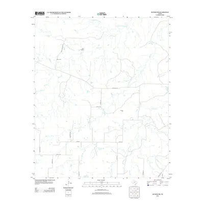
2012 Map of Dundee SW
USGS Topo · Published 2012About this map
Boone Ranch sits at the heart of this North Texas landscape, where cattle ranching and rural land use define the character of Baylor County. The terrain is deeply inscribed by a dense network of seasonal drainages, including Godwin Cr and Kickapoo Cr, which feed toward the N Fork Little Wichita River in the north. This 2012 survey illustrates how modern ranch roads, such as Ranch Road 422 and Ranch Road 210, have replaced older trails while maintaining the large-scale boundary lines of the region's historic cattle operations.
Find a feature on this map
25 named features on this map. Tap any name to fly to it.
Don’t see what you’re looking for? This feature index may not catch every label — zoom into the map to look around manually.
Map Details
Editions of this 2012 Dundee SW Map
This is the sole edition of this map. No revisions or reprints were ever made.
Other maps of this area

1932 · Dundee
USGS Topo · 1:62,500

1954 · Wichita Falls
USGS Topo · 1:250,000

1958 · Wichita Falls
USGS Topo · 1:250,000

1963 · Dundee
USGS Topo · 1:24,000

1963 · Dundee SW
USGS Topo · 1:24,000

1963 · Megargel
USGS Topo · 1:24,000

1964 · Dundee SE
USGS Topo · 1:24,000
1964 · Lake Olney
USGS Topo · 1:24,000

1966 · Fulda
USGS Topo · 1:24,000
1966 · Lake Kickapoo
USGS Topo · 1:24,000