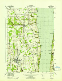
1943 Map of Dundee
USGS Topo · Published 1943About this map
The village of Dundee and the steep western shoreline of Seneca Lake define this 1943 War Department survey of the Finger Lakes region. Situated in the heart of wine country, the landscape is marked by numerous vineyards and the deeply incised ravines of Big Stream, Plum Creek, and Indian Run as they descend toward the lake. This edition reveals a mature transportation and social network during the early 1940s, including the dual presence of the Pennsylvania Railroad and the New York Central Railroad running parallel north-to-south. Settlement is concentrated in farming hamlets such as Himrod, Starkey, and Lakemont, the latter of which is anchored by the Lakemont Academy. The map also documents the many small lakeside landings like Lamoreaux Landing and Valois, reflecting the historic dependence on both rail and water for moving the region's agricultural bounty.
Find a feature on this map
56 named features on this map. Tap any name to fly to it.
Don’t see what you’re looking for? This feature index may not catch every label — zoom into the map to look around manually.
Map Details
Editions of this 1943 Dundee Map
This is the sole edition of this map. No revisions or reprints were ever made.
Other maps of this area

1898 · Watkins Glen
USGS Topo · 1:62,500

1901 · Watkins
USGS Topo · 1:62,500

1902 · Ovid
USGS Topo · 1:62,500

1903 · Penn Yan
USGS Topo · 1:62,500

1903 · Hammondsport
USGS Topo · 1:62,500

1905 · Watkins Glen
USGS Topo · 1:125,000

1942 · Penn Yan
USGS Topo · 1:31,680

1942 · Ovid
USGS Topo · 1:31,680

1942 · Dundee
USGS Topo · 1:24,000

1942 · Lodi
USGS Topo · 1:24,000