
1942 Map of Dundee
USGS Topo · Published 1957About this map
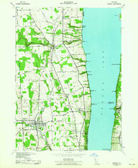
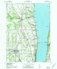
Seneca Lake dominates the eastern landscape of this 1940s-era survey, its shoreline dotted with points like Severne Pt and Baskin Pt while the interior terrain reflects a deeply rooted agricultural and institutional heritage. The village of Dundee serves as the inland hub, where the crossing of Big Stream and the Pennsylvania Railroad supported a growing community. To the north, the smaller settlement of Himrod sits at a strategic junction with the New York Central Railroad, illustrating the dual-rail economy that once fueled the region's movement of goods and people.
Find a feature on this map
64 named features on this map. Tap any name to fly to it.
Don’t see what you’re looking for? This feature index may not catch every label — zoom into the map to look around manually.
Map Details
Editions of this 1942 Dundee Map
3 editions found
Other maps of this area

1898 · Watkins Glen
USGS Topo · 1:62,500

1901 · Watkins
USGS Topo · 1:62,500

1902 · Ovid
USGS Topo · 1:62,500

1903 · Penn Yan
USGS Topo · 1:62,500

1903 · Hammondsport
USGS Topo · 1:62,500

1905 · Watkins Glen
USGS Topo · 1:125,000

1942 · Penn Yan
USGS Topo · 1:31,680

1942 · Ovid
USGS Topo · 1:31,680

1942 · Lodi
USGS Topo · 1:24,000

1942 · Keuka Park
USGS Topo · 1:24,000