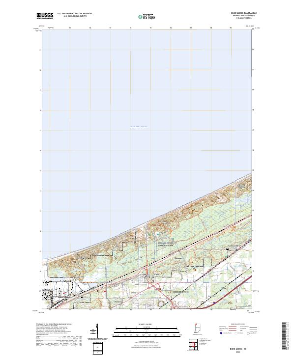
2022 Map of Dune Acres
USGS Topo · Published 2022About this map
Indiana Dunes National Park dominates this lakeshore landscape, where the shifting sands of the Lake Michigan coast meet complex wetland systems. Notable peaks such as Mt Tom, Mt Holden, and Mt Jackson stand as prominent landmarks overlooking a network of modern and historical transit routes, including the Calumet Trl and Glenwood Dunes Trl. The transition from the industrial infrastructure of the Baily Generating Sta in Burns Harbor to the quiet residential enclaves of Dune Acres and Beverly Shores illustrates the region's diverse land use.
Find a feature on this map
63 named features on this map. Tap any name to fly to it.
Don’t see what you’re looking for? This feature index may not catch every label — zoom into the map to look around manually.
Map Details
Editions of this 2022 Dune Acres Map
This is the sole edition of this map. No revisions or reprints were ever made.
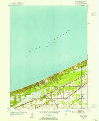
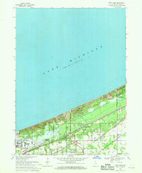
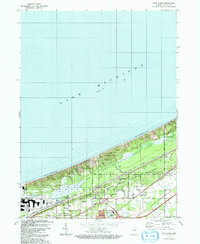
Historical Maps of Furnessville Through Time
4 maps found