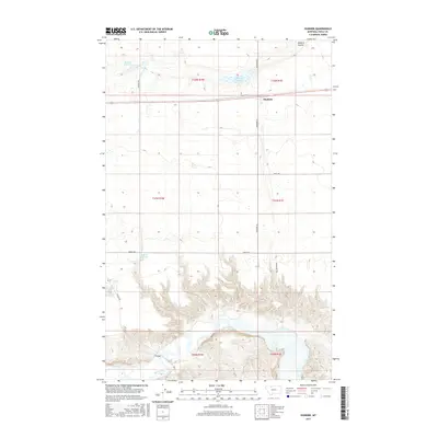
2017 Map of Dunkirk
USGS Topo · Published 2017About this map
Dunkirk and the surrounding high plains of Toole County are defined by a sophisticated system of water management and the winding course of the Marias River. This 2017 study illustrates the agricultural infrastructure of northern Montana, where local reservoirs like Melcott Reservoir, Dunkirk Reservoir, and Wilson Reservoir support the arid landscape. The northern portion of the map is dominated by the linear grid of the Public Land Survey System, while the southern section gives way to the complex, eroded topography surrounding the river valley. Significant transport and transit markers include the historic F Bridge and Dunkirk Coulee, along with a network of rural routes such as Hawkins Rd and Dobyns Rd that connect the isolated farmsteads and ranchlands of the region.
Find a feature on this map
21 named features on this map. Tap any name to fly to it.
Don’t see what you’re looking for? This feature index may not catch every label — zoom into the map to look around manually.
Map Details
Editions of this 2017 Dunkirk Map
This is the sole edition of this map. No revisions or reprints were ever made.
Other maps of this area

1920 · Conrad
USGS Topo · 1:125,000

1943 · Antelope Coulee
USGS Topo · 1:62,500

1943 · Shelby
USGS Topo · 1:62,500

1954 · Shelby
USGS Topo · 1:250,000

1958 · Shelby
USGS Topo · 1:250,000

1967 · Central School
USGS Topo · 1:24,000

1967 · Naismith
USGS Topo · 1:24,000

1967 · Conrad Butte
USGS Topo · 1:24,000

1967 · South Devon School
USGS Topo · 1:24,000

1967 · Dunkirk
USGS Topo · 1:24,000