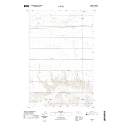
2020 Map of Dunkirk
USGS Topo · Published 2020About this map
Dunkirk anchors this portion of the northern Montana plains, situated along a primary transportation corridor that traverses the open landscape. The terrain is defined by a series of agricultural sections and water management features essential to the region's ranching and farming economy, including the Dunkirk Reservoir and Wilson Reservoir. To the south, the topography shifts dramatically as the land drops into the intricate breaks of the Marias River valley. This waterway, winding through deep coulees like the Dunkirk Coulee, provides a sharp contrast to the flat tablelands above. Local infrastructure is represented by a grid of rural routes such as Hawkins Rd and Robertson Rd, leading toward crossings like the F Bridge, which spans the river's lower reach within this quadrangle.
Find a feature on this map
20 named features on this map. Tap any name to fly to it.
Don’t see what you’re looking for? This feature index may not catch every label — zoom into the map to look around manually.
Map Details
Editions of this 2020 Dunkirk Map
This is the sole edition of this map. No revisions or reprints were ever made.
Other maps of this area

1920 · Conrad
USGS Topo · 1:125,000

1943 · Antelope Coulee
USGS Topo · 1:62,500

1943 · Shelby
USGS Topo · 1:62,500

1954 · Shelby
USGS Topo · 1:250,000

1958 · Shelby
USGS Topo · 1:250,000

1967 · Central School
USGS Topo · 1:24,000

1967 · Naismith
USGS Topo · 1:24,000

1967 · Conrad Butte
USGS Topo · 1:24,000

1967 · South Devon School
USGS Topo · 1:24,000

1967 · Dunkirk
USGS Topo · 1:24,000