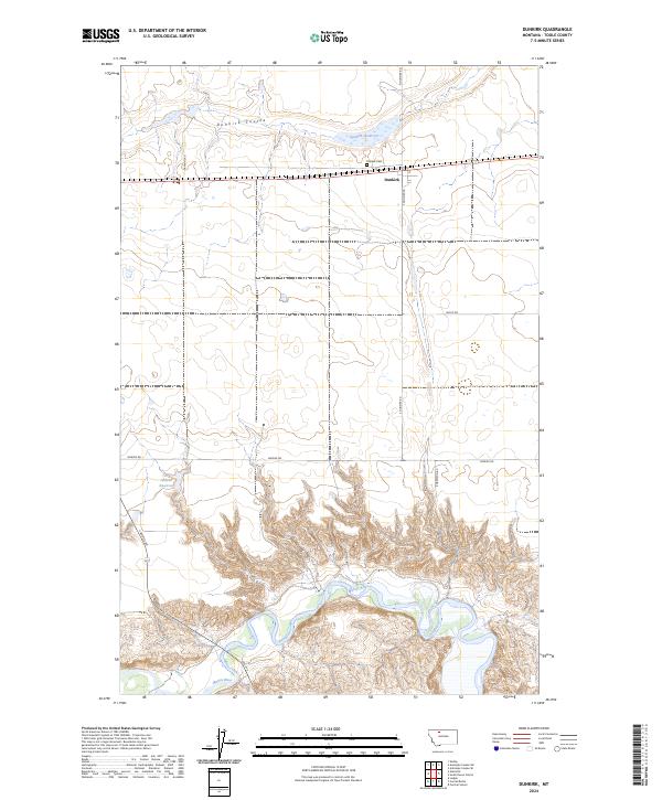
2024 Map of Dunkirk
USGS Topo · Published 2024About this map
Dunkirk anchors this portion of the Montana high plains, situated at a transition between the northern coulee country and the deeply incised valley of the Marias River. The landscape is defined by the sharp contrast between the level agricultural benches and the complex breaks and meanders where the river carves through the southern sections. Local water management is evident in features like the Dunkirk Reservoir and Wilson Reservoir, essential infrastructure for a region shaped by its drainage patterns. The town's local history is rooted near the Dunkirk Cem and the seasonal flows of the Dunkirk Coulee, which winds through the northern townships. A network of rural roads, including N Dunkirk Rd and Dobyns Rd, reveals the rectilinear grid of land divisions that governs movement across this expansive terrain.
Find a feature on this map
20 named features on this map. Tap any name to fly to it.
Don’t see what you’re looking for? This feature index may not catch every label — zoom into the map to look around manually.
Map Details
Editions of this 2024 Dunkirk Map
This is the sole edition of this map. No revisions or reprints were ever made.
Other maps of this area

1920 · Conrad
USGS Topo · 1:125,000

1943 · Antelope Coulee
USGS Topo · 1:62,500

1943 · Shelby
USGS Topo · 1:62,500

1954 · Shelby
USGS Topo · 1:250,000

1958 · Shelby
USGS Topo · 1:250,000

1967 · Central School
USGS Topo · 1:24,000

1967 · Naismith
USGS Topo · 1:24,000

1967 · Conrad Butte
USGS Topo · 1:24,000

1967 · South Devon School
USGS Topo · 1:24,000

1967 · Dunkirk
USGS Topo · 1:24,000