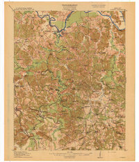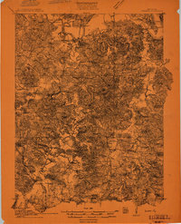
1911 Map of Dunmor
USGS Topo · Published 1911About this map
Green River and the Mud River serve as the central arteries of this 1911 landscape, where river-based transport and early mining commerce define the local economy. Critical transit points such as Belview Ferry and Doolins Ferry provide essential crossings between Muhlenberg and Butler Counties, while the presence of Mining City and Skilesville indicates a region deeply tied to its natural resources and river access. The density of small institutions, including Iron Mountain School and Ebenezer Church, suggests a series of tight-knit upland communities established along the complex network of creeks like Wolf Lick and Hazel Creek. Notable river landmarks like Grindstone Bend and 여러 landing sites like Winters Landing reflect the era's reliance on waterborne trade and travel before the widespread development of modern highway infrastructure.
Find a feature on this map
37 named features on this map. Tap any name to fly to it.
Don’t see what you’re looking for? This feature index may not catch every label — zoom into the map to look around manually.
Map Details
Editions of this 1911 Dunmor Map
This is the sole edition of this map. No revisions or reprints were ever made.
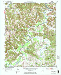
Historical Maps of Rochester Through Time
8 maps found