
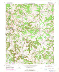
1951 Map of Homer
USGS Topo · Published 1953About this map
The winding Mud River and its numerous tributaries, including Greasy Cr and Patterson Creek, carve a complex pattern across this rural Logan County landscape. Small agricultural hubs and crossroads like Homer and Costelow serve as anchor points for a community connected by a dense network of country roads. The distribution of landmark churches, such as Chandlers Chapel and Sycamore Ch, reflects the social geography of the early 1950s, where local congregations and small cemeteries like Cedar Grove Cem were the primary centers of rural life.
Find a feature on this map
23 named features on this map. Tap any name to fly to it.
Don’t see what you’re looking for? This feature index may not catch every label — zoom into the map to look around manually.
Map Details
Editions of this 1951 Homer Map
2 editions found
Other maps of this area

1911 · Dunmor
USGS Topo · 1:48,000

1914 · Little Muddy
USGS Topo · 1:62,500

1914 · Dunmor
USGS Topo · 1:62,500

1951 · Auburn
USGS Topo · 1:24,000

1951 · Lewisburg
USGS Topo · 1:24,000

1951 · South Union
USGS Topo · 1:24,000

1952 · Russellville
USGS Topo · 1:24,000

1952 · Dennis
USGS Topo · 1:24,000

1953 · Dunmor
USGS Topo · 1:24,000

1953 · Quality
USGS Topo · 1:24,000