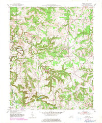
1951 Map of Homer
USGS Topo · Published 1983About this map
Logan County’s agricultural landscape is defined here by the winding drainages of Muddy Creek and its many tributaries, captured in a transition period when 1950s rural life met late 20th-century revisions. The map reveals a tight-knit network of small communities such as Costelow and Chandlers Chapel, where life centered around landmarks like Sycamore Ch and Big Muddy Ch. The terrain is marked by significant topographical relief, particularly around the many creeks feeding into the main River at the southern border.
Find a feature on this map
23 named features on this map. Tap any name to fly to it.
Don’t see what you’re looking for? This feature index may not catch every label — zoom into the map to look around manually.
Map Details
Editions of this 1951 Homer Map
2 editions found
Other maps of this area

1911 · Dunmor
USGS Topo · 1:48,000

1914 · Little Muddy
USGS Topo · 1:62,500

1914 · Dunmor
USGS Topo · 1:62,500

1951 · Auburn
USGS Topo · 1:24,000

1951 · Lewisburg
USGS Topo · 1:24,000

1951 · South Union
USGS Topo · 1:24,000

1951 · Homer
USGS Topo · 1:24,000

1952 · Russellville
USGS Topo · 1:24,000

1952 · Dennis
USGS Topo · 1:24,000

1953 · Dunmor
USGS Topo · 1:24,000