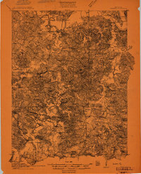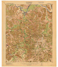
1914 Map of Dunmor
USGS Topo · Published 1914About this map
Green River and Mud River serve as the primary geographical anchors for this region of western Kentucky, where the convergence of Muhlenberg, Butler, Logan, and Ohio counties creates a landscape defined by river-based commerce and upland agriculture. The industrial presence of the Mud River Mine stands out among the dispersed farming communities, while the prevalence of ferries and landings, such as Winters Landing and Doolins Ferry, highlights how essential the waterways were for transportation before modern bridges.
Find a feature on this map
120 named features on this map. Tap any name to fly to it.
Don’t see what you’re looking for? This feature index may not catch every label — zoom into the map to look around manually.
Map Details
Editions of this 1914 Dunmor Map
This is the sole edition of this map. No revisions or reprints were ever made.
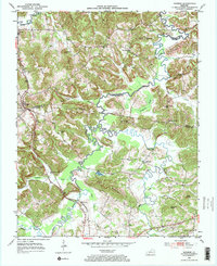
Historical Maps of Rochester Through Time
8 maps found