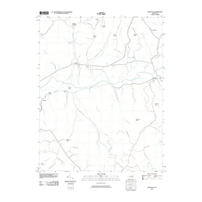
2010 Map of Dunnville
USGS Topo · Published 2010About this map
The Green River meanders across this rural landscape, serving as the central geographic feature for the small communities and family ridge-lands in Adair County. In the eastern portion of the sheet, the settlement of Dunnville sits near the river's bend, while Pellyton and Barnett Springs anchor the northern reaches. The area is defined by a dense network of ridges and hollows, including Sanders Ridge, Nubbin Ridge, and Gundy Hollow. Family history is deeply rooted here, evidenced by numerous small burial grounds such as Jones Cemetery, Austin Cemetery, and the Thomastown Cemetery located south of the main river channel. Transport patterns are shaped by the terrain, with local routes like Pellyton East Rd and Dunnville Rd following the natural contours of the land and connecting remote farmsteads to the primary river valley.
Find a feature on this map
65 named features on this map. Tap any name to fly to it.
Don’t see what you’re looking for? This feature index may not catch every label — zoom into the map to look around manually.
Map Details
Editions of this 2010 Dunnville Map
This is the sole edition of this map. No revisions or reprints were ever made.
Other maps of this area

1952 · Clementsville
USGS Topo · 1:24,000

1952 · Liberty
USGS Topo · 1:24,000

1952 · Mannsville
USGS Topo · 1:24,000

1953 · Phil
USGS Topo · 1:24,000

1953 · Montpelier
USGS Topo · 1:24,000

1953 · Dunnville
USGS Topo · 1:24,000

1954 · Knifley
USGS Topo · 1:24,000

1954 · Russell Springs
USGS Topo · 1:24,000

1954 · Eli
USGS Topo · 1:24,000

1957 · Winchester
USGS Topo · 1:250,000