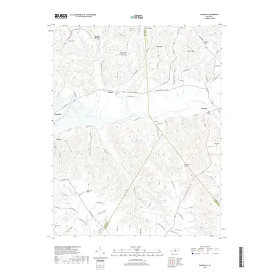
2019 Map of Dunnville
USGS Topo · Published 2019About this map
The Green River meanders across this rural landscape, forming the heart of a region defined by intricate ridges and hollows at the borders of Adair, Casey, and Russell Counties. The community of Dunnville serves as a primary hub near the eastern edge, while the settlements of Pellyton, Neatsville, and Eunice anchor the agricultural and residential life of the surrounding valleys. The map reveals a high concentration of family and community burial sites, such as Hatfield Cem, Austin Cem, and the Thomastown Cem, reflecting deep-rooted generational ties to the land.
Find a feature on this map
98 named features on this map. Tap any name to fly to it.
Don’t see what you’re looking for? This feature index may not catch every label — zoom into the map to look around manually.
Map Details
Editions of this 2019 Dunnville Map
This is the sole edition of this map. No revisions or reprints were ever made.
Other maps of this area

1952 · Clementsville
USGS Topo · 1:24,000

1952 · Liberty
USGS Topo · 1:24,000

1952 · Mannsville
USGS Topo · 1:24,000

1953 · Phil
USGS Topo · 1:24,000

1953 · Montpelier
USGS Topo · 1:24,000

1953 · Dunnville
USGS Topo · 1:24,000

1954 · Knifley
USGS Topo · 1:24,000

1954 · Russell Springs
USGS Topo · 1:24,000

1954 · Eli
USGS Topo · 1:24,000

1957 · Winchester
USGS Topo · 1:250,000