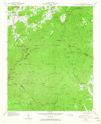
1942 Map of Dunsmore Mountain
USGS Topo · Published 1965About this map
Pisgah National Forest dominates this 1942 landscape, where the high ridges of the Blue Ridge Mountains converge at the borders of Buncombe, Henderson, Haywood, and Transylvania counties. The map reflects a period of established federal land management, highlighting the Bent Creek Experimental Forest and the North Mills River Recreation Area. In the northwest corner, the rural community life along South Hominy Creek is anchored by Pisgah Ch and a local Cem, while higher elevations feature landmarks like Buck Spring Lodge and a Lookout Tower on Ferrin Knob. This survey captures the intricate drainage patterns of the French Broad watershed, from the headwaters of the North Fork Mills River to the Hendersonville Reservoir, providing a detailed record of the trails, gaps, and family-named knobs before mid-century development.
Find a feature on this map
173 named features on this map. Tap any name to fly to it.
Don’t see what you’re looking for? This feature index may not catch every label — zoom into the map to look around manually.
Map Details
Editions of this 1942 Dunsmore Mountain Map
2 editions found
Other maps of this area

1894 · Asheville
USGS Topo · 1:125,000

1901 · Asheville
USGS Topo · 1:125,000

1905 · Pisgah
USGS Topo · 1:125,000

1906 · Pisgah
USGS Topo · 1:125,000

1935 · Cruso
USGS Topo · 1:24,000

1935 · Canton
USGS Topo · 1:24,000

1935 · Horse Shoe
USGS Topo · 1:24,000

1935 · Shining Rock
USGS Topo · 1:24,000

1935 · Pisgah Forest
USGS Topo · 1:24,000

1936 · Enka
USGS Topo · 1:24,000