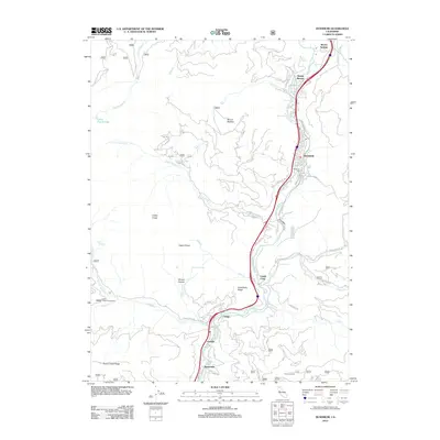
2012 Map of Dunsmuir
USGS Topo · Published 2012About this map
Dunsmuir and its neighboring settlements along the Sacramento River corridor define this 2012 study of the Siskiyou mountain landscape. The geography is dominated by the dramatic granite spires of Castle Crags and Castle Dome, with the river serving as the central artery for transportation and leisure. Historic resort sites and springs, including Shasta Springs, Shasta Retreat, and Upper Soda Springs, cluster in the northern section, reflecting the area's long-standing draw for travelers. The map traces the winding paths of the water, from the cascading Mossbrae Falls to the various tributaries like Castle Creek and Soda Creek.
Find a feature on this map
55 named features on this map. Tap any name to fly to it.
Don’t see what you’re looking for? This feature index may not catch every label — zoom into the map to look around manually.
Map Details
Editions of this 2012 Dunsmuir Map
This is the sole edition of this map. No revisions or reprints were ever made.
Other maps of this area

1886 · Shasta
USGS Topo · 1:250,000

1894 · Shasta
USGS Topo · 1:250,000

1935 · Dunsmuir
USGS Topo · 1:125,000

1948 · Weed
USGS Topo · 1:250,000

1950 · Weed
USGS Topo · 1:250,000

1954 · Shoeinhorse Mountain
USGS Topo · 1:62,500

1954 · Shasta
USGS Topo · 1:62,500

1954 · Weed
USGS Topo · 1:62,500

1954 · Dunsmuir
USGS Topo · 1:62,500

1958 · Weed
USGS Topo · 1:250,000