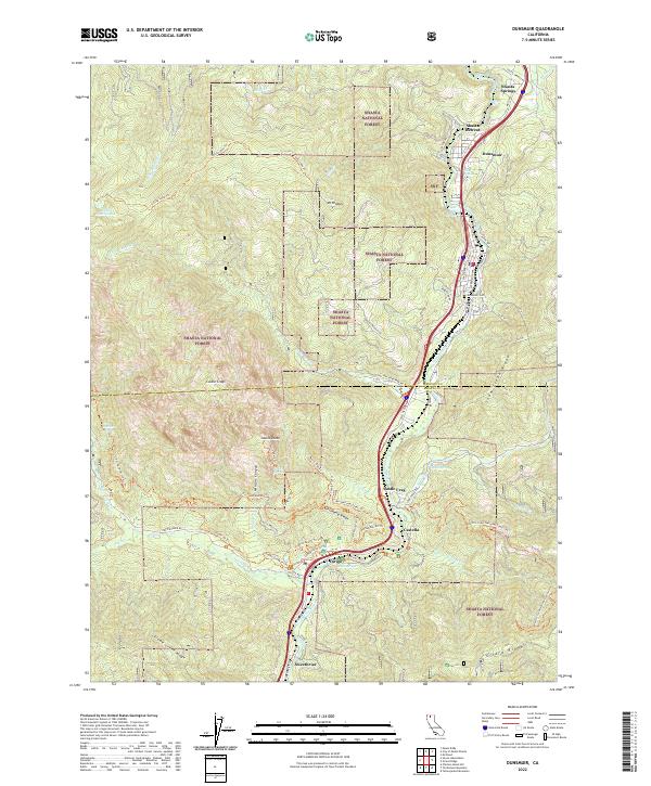
2022 Map of Dunsmuir
USGS Topo · Published 2022About this map
The Sacramento River carves a deep canyon through this portion of the Shasta National Forest, serving as the primary corridor for both the Union Pacific railroad and regional travel. The settlement of Dunsmuir anchors the northern canyon, supported by smaller historical communities like Shasta Retreat, Castella, and Sweetbriar. This steep topography is defined by dramatic vertical relief, from the granite spires of Castle Crags and Castle Dome to the prominent heights of Mt Bradley and Girard Ridge. The map documents a landscape where water and transit meet, featuring numerous named springs such as Upper Soda Springs, Cave Springs, and the spectacular Mossbrae Falls. Hikers can trace the winding path of the Pacific Crest National Scenic Trl as it traverses the ridges, while genealogists may find interest in the location of the Dunsmuir Cem overlooking the river valley.
Find a feature on this map
77 named features on this map. Tap any name to fly to it.
Don’t see what you’re looking for? This feature index may not catch every label — zoom into the map to look around manually.
Map Details
Editions of this 2022 Dunsmuir Map
This is the sole edition of this map. No revisions or reprints were ever made.
Other maps of this area

1886 · Shasta
USGS Topo · 1:250,000

1894 · Shasta
USGS Topo · 1:250,000

1935 · Dunsmuir
USGS Topo · 1:125,000

1948 · Weed
USGS Topo · 1:250,000

1950 · Weed
USGS Topo · 1:250,000

1954 · Shoeinhorse Mountain
USGS Topo · 1:62,500

1954 · Shasta
USGS Topo · 1:62,500

1954 · Weed
USGS Topo · 1:62,500

1954 · Dunsmuir
USGS Topo · 1:62,500

1958 · Weed
USGS Topo · 1:250,000