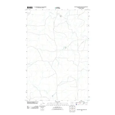
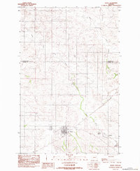
2011 Map of Duplisse Creek South
USGS Topo · Published 2011About this map
East Redwater Creek and its various tributaries define this section of Richland County, where the landscape is marked by the systematic management of water for agricultural use. This 2011 survey reveals a network of small-scale infrastructure, including Fatzinger Number 2 Dam to the north and Crocket Dam near the center of the sheet. The drainage patterns of Duplisse Creek and North Fork Lisk Creek illustrate the natural topography of the high plains, while the rectilinear road system, including County Hwy 308 and County Rd 127, highlights the township-and-range land division. Down in the southern reaches, the Bahls Dam stands as another example of local water engineering in this sparsely settled region of Montana.
Find a feature on this map
10 named features on this map. Tap any name to fly to it.
Don’t see what you’re looking for? This feature index may not catch every label — zoom into the map to look around manually.
Map Details
Editions of this 2011 Duplisse Creek South Map
This is the sole edition of this map. No revisions or reprints were ever made.
Other maps of this area

1909 · Glendive
USGS Topo · 1:250,000

1954 · Glendive
USGS Topo · 1:250,000

1957 · Glendive
USGS Topo · 1:250,000

1958 · Glendive
USGS Topo · 1:250,000

1972 · Kuester Lake
USGS Topo · 1:24,000

1981 · Sidney
USGS Topo · 1:100,000
1983 · Duplisse Creek North
USGS Topo · 1:24,000
1983 · Sullivan Coulee
USGS Topo · 1:24,000
1983 · Duplisse Creek South
USGS Topo · 1:24,000
1983 · Richey
USGS Topo · 1:24,000