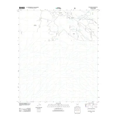
2012 Map of Duquesne
USGS Topo · Published 2012About this map
Duquesne sits at the heart of this high-elevation terrain near the international border, where the landscape is defined by the steep slopes of Mount Washington and the drainage of Duquesne Wash. The map records a sparse network of ranching and mining infrastructure, including the Trask Ranch and Heady-Ashburn Ranch connected by unpaved corridors like W Mine Rd and Duquesne Rd. Water management is central to the area's utility, evidenced by a dense concentration of stock tanks such as Upper Thirteen Tank, Lower One Tank, and East Ten Tank. Natural water sources like Benton Spring and Line Boy Spring are mapped alongside deep geographical features including Washington Gulch and Antonio Canyon, providing a detailed look at the resource-dependent settlements in this part of Santa Cruz County.
Find a feature on this map
20 named features on this map. Tap any name to fly to it.
Don’t see what you’re looking for? This feature index may not catch every label — zoom into the map to look around manually.
Map Details
Editions of this 2012 Duquesne Map
This is the sole edition of this map. No revisions or reprints were ever made.
Other maps of this area

1905 · Nogales
USGS Topo · 1:125,000

1932 · Lochiel
USGS Topo · 1:62,500

1933 · Calabasas
USGS Topo · 1:62,500

1948 · Canelo Pass
USGS Topo · 1:24,000
1948 · Lochiel SE
USGS Topo · 1:24,000

1948 · Harshaw
USGS Topo · 1:24,000
1948 · Duquesne
USGS Topo · 1:24,000
1948 · Lochiel
USGS Topo · 1:62,500

1956 · Nogales
USGS Topo · 1:250,000

1958 · Nogales
USGS Topo · 1:250,000