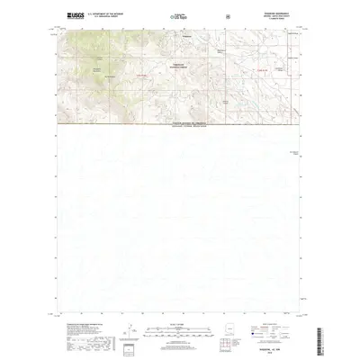
2018 Map of Duquesne
USGS Topo · Published 2018About this map
Duquesne sits at the high northern edge of this high-desert survey, situated within the Coronado National Forest near the peaks of the Patagonia Mountains. The terrain is defined by dramatic elevation changes, rising from the San Rafael Valley in the east toward Mt Washington. This region is a complex network of canyons and gulches, including Italian Canyon, Washington Gulch, and Antonio Canyon, which channel seasonal water into the Duquesne Wash.
Find a feature on this map
28 named features on this map. Tap any name to fly to it.
Don’t see what you’re looking for? This feature index may not catch every label — zoom into the map to look around manually.
Map Details
Editions of this 2018 Duquesne Map
This is the sole edition of this map. No revisions or reprints were ever made.
Other maps of this area

1905 · Nogales
USGS Topo · 1:125,000

1932 · Lochiel
USGS Topo · 1:62,500

1933 · Calabasas
USGS Topo · 1:62,500

1948 · Canelo Pass
USGS Topo · 1:24,000
1948 · Lochiel SE
USGS Topo · 1:24,000

1948 · Harshaw
USGS Topo · 1:24,000
1948 · Duquesne
USGS Topo · 1:24,000
1948 · Lochiel
USGS Topo · 1:62,500

1956 · Nogales
USGS Topo · 1:250,000

1958 · Nogales
USGS Topo · 1:250,000