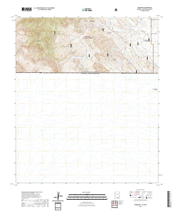
2021 Map of Duquesne
USGS Topo · Published 2021About this map
The mountain settlement of Duquesne sits high in the southern Patagonia Mountains, a remote outpost along the international border with Mexico. This 2021 survey illustrates a landscape of complex topography within the Coronado National Forest, where the terrain drops sharply from the heights of Mt Washington into the expansive San Rafael Valley to the east. The map records numerous water management features essential for ranching and survival in this arid environment, including Little Boy Spring, Benton Spring, and a series of numbered tanks such as Upper Thirteen Tank and North Fourteen Tank.
Find a feature on this map
28 named features on this map. Tap any name to fly to it.
Don’t see what you’re looking for? This feature index may not catch every label — zoom into the map to look around manually.
Map Details
Editions of this 2021 Duquesne Map
This is the sole edition of this map. No revisions or reprints were ever made.
Other maps of this area

1905 · Nogales
USGS Topo · 1:125,000

1932 · Lochiel
USGS Topo · 1:62,500

1933 · Calabasas
USGS Topo · 1:62,500

1948 · Canelo Pass
USGS Topo · 1:24,000
1948 · Lochiel SE
USGS Topo · 1:24,000

1948 · Harshaw
USGS Topo · 1:24,000
1948 · Duquesne
USGS Topo · 1:24,000
1948 · Lochiel
USGS Topo · 1:62,500

1956 · Nogales
USGS Topo · 1:250,000

1958 · Nogales
USGS Topo · 1:250,000