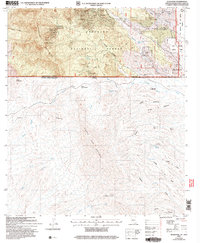
2004 Map of Duquesne
USGS Topo · Published 2007About this map
The Patagonia Mountains rise sharply along the international border in this high-desert mining district. The settlement of Duquesne sits at the heart of a cluster of historic mineral extraction sites including the Belmont Mine, Bonanza Mine, and Dudley Mine. This terrain, managed as part of the Coronado National Forest, is deeply incised by drainages like Washington Gulch and Paradise Canyon. The geography reflects the shared landscape of the United States and Mexico, where the northern peaks of the Sierra San Antonio descend into broad valleys characterized by seasonal washes and cattle tanks. Significant mining infrastructure is concentrated on the American side, evidenced by numerous adits and shafts like the Santo Nino Mine, while the southern topography is dominated by expansive systems such as Cañada San Antonio and the high pass at Puerto Comedero de Tierra.
Find a feature on this map
61 named features on this map. Tap any name to fly to it.
Don’t see what you’re looking for? This feature index may not catch every label — zoom into the map to look around manually.
Map Details
Editions of this 2004 Duquesne Map
This is the sole edition of this map. No revisions or reprints were ever made.
Other maps of this area

1905 · Nogales
USGS Topo · 1:125,000

1932 · Lochiel
USGS Topo · 1:62,500

1933 · Calabasas
USGS Topo · 1:62,500

1948 · Canelo Pass
USGS Topo · 1:24,000
1948 · Lochiel SE
USGS Topo · 1:24,000

1948 · Harshaw
USGS Topo · 1:24,000
1948 · Duquesne
USGS Topo · 1:24,000
1948 · Lochiel
USGS Topo · 1:62,500

1956 · Nogales
USGS Topo · 1:250,000

1958 · Nogales
USGS Topo · 1:250,000