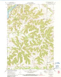
1972 Map of Durand South
USGS Topo · Published 1991About this map
Chippewa River waters define the northwestern corner of this landscape, where the Chicago Milwaukee St Paul and Pacific railroad tracks parallel the bank past the settlement of Waterville. The terrain quickly transitions into a complex network of narrow valleys and ridges, notably the prominent Dividing Ridge and the agricultural corridors of Golden Valley, Weisenbeck Valley, and Owens Valley.
Find a feature on this map
28 named features on this map. Tap any name to fly to it.
Don’t see what you’re looking for? This feature index may not catch every label — zoom into the map to look around manually.
Map Details
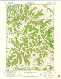
Editions of this 1972 Durand South Map
2 editions found
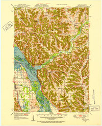
Other maps of this area

1929 · Durand
USGS Topo · 1:62,500

1932 · Wabasha
USGS Topo · 1:62,500

1932 · Durand
USGS Topo · 1:62,500

1932 · Alma
USGS Topo · 1:62,500

1935 · Arkansaw
USGS Topo · 1:48,000

1941 · Arkansaw
USGS Topo · 1:62,500

1942 · Arkansaw
USGS Topo · 1:62,500
1950 · Alma
USGS Topo · 1:62,500

1951 · Wabasha
USGS Topo · 1:62,500

1953 · Saint Paul
USGS Topo · 1:250,000