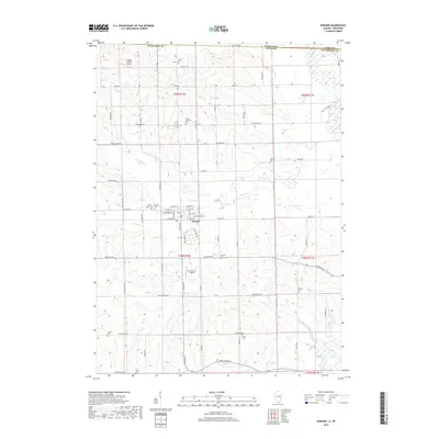
2018 Map of Durand
USGS Topo · Published 2018About this map
Durand serves as the central hub for this borderlands survey, where the agricultural plains of northern Illinois meet the Wisconsin state line. The landscape is defined by the winding course of the Sugar River and Otter Cr, which feed into the Pecatonica River at the map's southern edge. This 2018 edition reveals a significant concentration of rural burial grounds that speak to the area's long-standing township history, including Laona Township Cem, Hanford Cem, and Oakland Cem. Local aviation is represented by private facilities such as the Flying Z Ranch Airport near the northern boundary and Mc Cartney Airport further south. The map provides a contemporary look at the township's grid of named roads like Yale Bridge Rd and State Line Rd, which bridge the gap between historic family farms and modern land use.
Find a feature on this map
72 named features on this map. Tap any name to fly to it.
Don’t see what you’re looking for? This feature index may not catch every label — zoom into the map to look around manually.
Map Details
Editions of this 2018 Durand Map
This is the sole edition of this map. No revisions or reprints were ever made.
Other maps of this area

1891 · Janesville
USGS Topo · 1:62,500

1893 · Janesville
USGS Topo · 1:62,500

1893 · Brodhead
USGS Topo · 1:62,500

1918 · Rockford
USGS Topo · 1:62,500

1932 · Pecatonica
USGS Topo · 1:62,500

1936 · Pecatonica
USGS Topo · 1:62,500

1938 · Rockford
USGS Topo · 1:62,500

1954 · Rockford
USGS Topo · 1:250,000

1955 · Rockford
USGS Topo · 1:250,000

1958 · Rockford
USGS Topo · 1:250,000