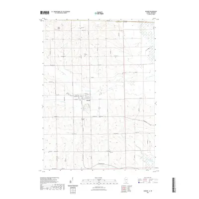
2021 Map of Durand
USGS Topo · Published 2021About this map
Durand serves as the central hub of this northern Illinois landscape, positioned just south of the Wisconsin-Illinois border near the confluence of the Sugar River and several drainage creeks. The village is organized around a traditional street grid including W Main St and E North St, surrounded by an extensive network of rural burial grounds that speak to the area's deep-rooted township history. Genealogists will find a high concentration of cemeteries such as Laona Township Cem, Saint Marys Cem, and Fenton Cem distributed across the prairie. The terrain is defined by the winding paths of Otter Cr and N Br Otter Cr, which feed into the larger river systems. Beyond the agricultural fields, the map identifies small-scale aviation landmarks like McCartney Airport and the Flying Z Ranch Airport, reflecting the region's mid-continent rural character.
Find a feature on this map
46 named features on this map. Tap any name to fly to it.
Don’t see what you’re looking for? This feature index may not catch every label — zoom into the map to look around manually.
Map Details
Editions of this 2021 Durand Map
This is the sole edition of this map. No revisions or reprints were ever made.
Other maps of this area

1891 · Janesville
USGS Topo · 1:62,500

1893 · Janesville
USGS Topo · 1:62,500

1893 · Brodhead
USGS Topo · 1:62,500

1918 · Rockford
USGS Topo · 1:62,500

1932 · Pecatonica
USGS Topo · 1:62,500

1936 · Pecatonica
USGS Topo · 1:62,500

1938 · Rockford
USGS Topo · 1:62,500

1954 · Rockford
USGS Topo · 1:250,000

1955 · Rockford
USGS Topo · 1:250,000

1958 · Rockford
USGS Topo · 1:250,000