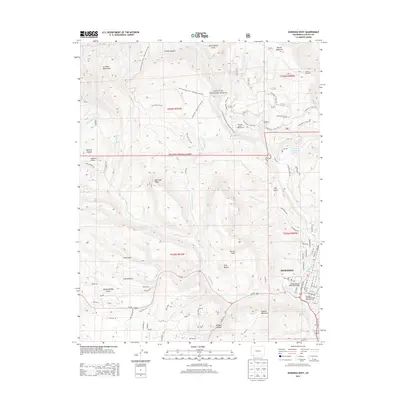
2013 Map of Durango West
USGS Topo · Published 2013About this map
Durango and its immediate western outskirts are defined by the convergence of steep alpine terrain and the historic industrial corridor along the Animas River. The eastern edge of this 2013 survey shows the city's residential grid and the path of the Durango-Silverton Narrow-Gauge Railroad, which remains a vital link to the region's mining heritage. West of the river, landmarks like Smelter Mountain and Twin Buttes rise sharply above the valley floor, giving way to the protected expanses of the San Juan National Forest. The map documents a complex network of recreational and historic paths, including the Junction Creek Trail / Colorado Trail 553 and the Logchutes 1 Trail 150 systems. Local history is etched into the landscape via labels like Coal Gulch and Cherry Gulch, reflecting the resource extraction that once fueled the growth of this mountain hub.
Find a feature on this map
86 named features on this map. Tap any name to fly to it.
Don’t see what you’re looking for? This feature index may not catch every label — zoom into the map to look around manually.
Map Details
Editions of this 2013 Durango West Map
This is the sole edition of this map. No revisions or reprints were ever made.
Other maps of this area

1895 · La Plata
USGS Topo · 1:62,500

1897 · La Plata
USGS Topo · 1:62,500

1898 · Durango
USGS Topo · 1:62,500

1899 · La Plata
USGS Topo · 1:62,500

1907 · Durango
USGS Topo · 1:62,500

1908 · Ignacio
USGS Topo · 1:125,000

1908 · Durango
USGS Topo · 1:62,500

1908 · La Plata
USGS Topo · 1:62,500

1913 · Red Mesa
USGS Topo · 1:62,500

1924 · Ignacio
USGS Topo · 1:125,000