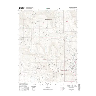
2016 Map of Durango West
USGS Topo · Published 2016About this map
The western edges of Durango and the high country of the San Juan National Forest define this landscape along the Animas River. The transition from urban center to wilderness is marked by landmarks like the Gardenswartz Memorial Bridge and the sprawling Greenmount Cem. To the west, the terrain rises sharply toward Perins Peak and Smelter Mtn, where numerous canyons and draws like Wildcat Canyon and Coal Gulch cut through the topography.
Find a feature on this map
117 named features on this map. Tap any name to fly to it.
Don’t see what you’re looking for? This feature index may not catch every label — zoom into the map to look around manually.
Map Details
Editions of this 2016 Durango West Map
This is the sole edition of this map. No revisions or reprints were ever made.
Other maps of this area

1895 · La Plata
USGS Topo · 1:62,500

1897 · La Plata
USGS Topo · 1:62,500

1898 · Durango
USGS Topo · 1:62,500

1899 · La Plata
USGS Topo · 1:62,500

1907 · Durango
USGS Topo · 1:62,500

1908 · Ignacio
USGS Topo · 1:125,000

1908 · Durango
USGS Topo · 1:62,500

1908 · La Plata
USGS Topo · 1:62,500

1913 · Red Mesa
USGS Topo · 1:62,500

1924 · Ignacio
USGS Topo · 1:125,000