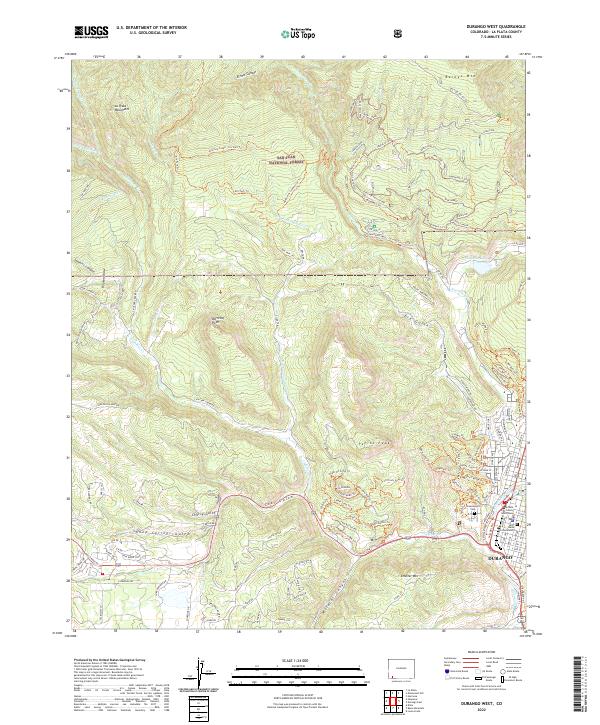
2022 Map of Durango West
USGS Topo · Published 2022About this map
The western edge of Durango meets the steep rising terrain of the San Juan National Forest in this topographic study. This area is defined by the sharp transition from the Animas River valley to high-elevation landmarks such as Perins Peak and the La Plata Mountains. Historically significant sites like the Greenmount Cem and the La Plata County Courthouse anchor the town's urban grid, while the surrounding landscape is marked by complex drainage networks including Lightner Cr and Coal Gulch. The map reveals a modern recreational and residential footprint, with extensive trail systems like the Logchutes 1 Trl and Dry Fork Trl weaving through the canyons. Notable local features like Smelter Mtn and Lake Durango further illustrate the area's development alongside its natural barriers.
Find a feature on this map
161 named features on this map. Tap any name to fly to it.
Don’t see what you’re looking for? This feature index may not catch every label — zoom into the map to look around manually.
Map Details
Editions of this 2022 Durango West Map
This is the sole edition of this map. No revisions or reprints were ever made.
Other maps of this area

1895 · La Plata
USGS Topo · 1:62,500

1897 · La Plata
USGS Topo · 1:62,500

1898 · Durango
USGS Topo · 1:62,500

1899 · La Plata
USGS Topo · 1:62,500

1907 · Durango
USGS Topo · 1:62,500

1908 · Ignacio
USGS Topo · 1:125,000

1908 · Durango
USGS Topo · 1:62,500

1908 · La Plata
USGS Topo · 1:62,500

1913 · Red Mesa
USGS Topo · 1:62,500

1924 · Ignacio
USGS Topo · 1:125,000