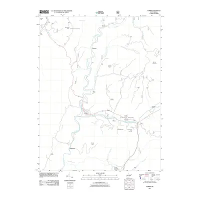
2011 Map of Durbin
USGS Topo · Published 2011About this map
The West Fork Greenbrier River and the East Fork Greenbrier River converge at Durbin, a key settlement in this mountain landscape. This survey reveals a pattern of dispersed smaller communities like Bartow, Frank, and Nottingham, connected by corridors such as the Old Pike Rd. Local history is preserved in numerous family and community burial sites, including Hauchen Cemetery, Keller Cemetery, and Yeager Cemetery. Higher elevations are marked by distinctive peaks like Gaudineer Knob, which features the Gaudineer Knob Lookout Tower, and Burner Mountain. The drainage network is dense, with named waterways like Shavers Fork, Blister Run, and Spillman Run carving through the terrain. Evidence of local water management appears at the Lake Buffalo Dam and the Coopers Rock Water Supply Dam near the southern boundary.
Find a feature on this map
42 named features on this map. Tap any name to fly to it.
Don’t see what you’re looking for? This feature index may not catch every label — zoom into the map to look around manually.
Map Details
Editions of this 2011 Durbin Map
This is the sole edition of this map. No revisions or reprints were ever made.
Other maps of this area

1889 · Beverly
USGS Topo · 1:125,000

1892 · Beverly
USGS Topo · 1:125,000

1901 · Monterey
USGS Topo · 1:125,000

1922 · Spruce Knob
USGS Topo · 1:48,000

1922 · Cass
USGS Topo · 1:48,000

1922 · Durbin
USGS Topo · 1:48,000

1924 · Cass
USGS Topo · 1:62,500

1924 · Durbin
USGS Topo · 1:62,500

1924 · Spruce Knob
USGS Topo · 1:62,500

1941 · Monterey
USGS Topo · 1:62,500