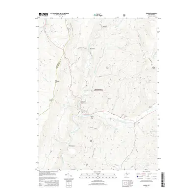
2016 Map of Durbin
USGS Topo · Published 2016About this map
The town of Durbin serves as the focal point of this survey, situated at the confluence where the East Fork Greenbrier River and West Fork Greenbrier River meet to form the Greenbrier River. This 2016 record shows the transition of industrial infrastructure into recreational use, specifically the W Fork Rail Trail which follows the river's winding path through the Monongahela National Forest. The landscape is defined by high-elevation peaks like Gaudineer Knob and Back Allegheny Mtn, with the county line between Randolph and Pocahontas following the mountain ridges. Cultural history is preserved through numerous family and community landmarks, including the Tannery Truss Bridge, the Mabel Burner Memorial Bridge, and a series of rural cemeteries such as Bethel Cem, Yeager Cem, and Saint Mark Cem. The map provides a detailed view of the small settlements of Nottingham, Olive, and Burner scattered along the river valley.
Find a feature on this map
49 named features on this map. Tap any name to fly to it.
Don’t see what you’re looking for? This feature index may not catch every label — zoom into the map to look around manually.
Map Details
Editions of this 2016 Durbin Map
This is the sole edition of this map. No revisions or reprints were ever made.
Other maps of this area

1889 · Beverly
USGS Topo · 1:125,000

1892 · Beverly
USGS Topo · 1:125,000

1901 · Monterey
USGS Topo · 1:125,000

1922 · Spruce Knob
USGS Topo · 1:48,000

1922 · Cass
USGS Topo · 1:48,000

1922 · Durbin
USGS Topo · 1:48,000

1924 · Cass
USGS Topo · 1:62,500

1924 · Durbin
USGS Topo · 1:62,500

1924 · Spruce Knob
USGS Topo · 1:62,500

1941 · Monterey
USGS Topo · 1:62,500