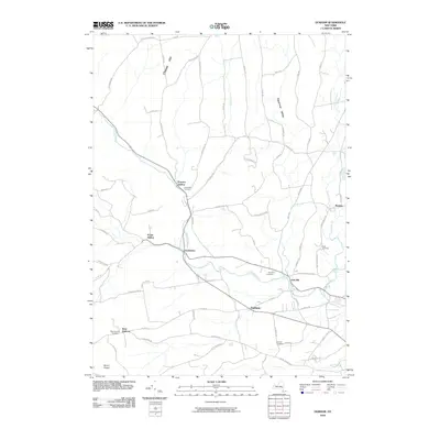
2010 Map of Durham
USGS Topo · Published 2010About this map
Catskill Creek winds through this Greene County landscape, serving as a central drainage for the small hamlets and agricultural valleys of the early 21st century. The map illustrates a network of historic settlements including Durham, Oak Hill, and Cooksburg, where local roads follow the natural contours of the land. High points like Cheese Hill and Mount Pisgah overlook the various hollows and valleys that define the local topography.
Find a feature on this map
68 named features on this map. Tap any name to fly to it.
Don’t see what you’re looking for? This feature index may not catch every label — zoom into the map to look around manually.
Map Details
Editions of this 2010 Durham Map
This is the sole edition of this map. No revisions or reprints were ever made.
Other maps of this area

1893 · Durham
USGS Topo · 1:62,500

1894 · Durham
USGS Topo · 1:62,500

1898 · Schoharie
USGS Topo · 1:62,500

1900 · Schoharie
USGS Topo · 1:62,500

1900 · Berne
USGS Topo · 1:62,500

1901 · Gilboa
USGS Topo · 1:62,500

1903 · Gilboa
USGS Topo · 1:62,500

1903 · Berne
USGS Topo · 1:62,500
1943 · Westerlo
USGS Topo · 1:24,000
1943 · Freehold
USGS Topo · 1:24,000