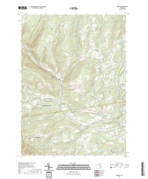
2023 Map of Durham
USGS Topo · Published 2023About this map
Catskill Creek carves a deep valley through this corner of the Catskill Mountains, where the borders of Schoharie, Albany, and Greene Counties converge. The landscape is defined by high ridges like Mount Pisgah and Scott Patent Hill, while the valley floors support a network of small, traditional hamlets that have anchored this region for generations. These settlements, including Preston Hollow, Potter Hollow, and Oak Hill, are connected by winding county routes that follow the natural topography of the creek beds.
Find a feature on this map
98 named features on this map. Tap any name to fly to it.
Don’t see what you’re looking for? This feature index may not catch every label — zoom into the map to look around manually.
Map Details
Editions of this 2023 Durham Map
This is the sole edition of this map. No revisions or reprints were ever made.
Other maps of this area

1893 · Durham
USGS Topo · 1:62,500

1894 · Durham
USGS Topo · 1:62,500

1898 · Schoharie
USGS Topo · 1:62,500

1900 · Schoharie
USGS Topo · 1:62,500

1900 · Berne
USGS Topo · 1:62,500

1901 · Gilboa
USGS Topo · 1:62,500

1903 · Gilboa
USGS Topo · 1:62,500

1903 · Berne
USGS Topo · 1:62,500
1943 · Westerlo
USGS Topo · 1:24,000
1943 · Freehold
USGS Topo · 1:24,000