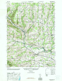
1945 Map of Durham
USGS Topo · Published 1967About this map
Catskill Creek carves a deep path through the Catskill foothills at the end of World War II, defining the local geography as it flows through Cooksburg and past the village of Oak Hill. The map captures a rural landscape where education and community life remained localized in numerous district schools, such as Cheese Hill School, Sayer Sch, and Craw Sch, even as the Durham Central Sch began to centralize local schooling.
Find a feature on this map
33 named features on this map. Tap any name to fly to it.
Don’t see what you’re looking for? This feature index may not catch every label — zoom into the map to look around manually.
Map Details
Editions of this 1945 Durham Map
This is the sole edition of this map. No revisions or reprints were ever made.
Other maps of this area

1893 · Durham
USGS Topo · 1:62,500

1894 · Durham
USGS Topo · 1:62,500

1898 · Schoharie
USGS Topo · 1:62,500

1900 · Schoharie
USGS Topo · 1:62,500

1900 · Berne
USGS Topo · 1:62,500

1901 · Gilboa
USGS Topo · 1:62,500

1903 · Gilboa
USGS Topo · 1:62,500

1903 · Berne
USGS Topo · 1:62,500
1943 · Westerlo
USGS Topo · 1:24,000
1943 · Freehold
USGS Topo · 1:24,000