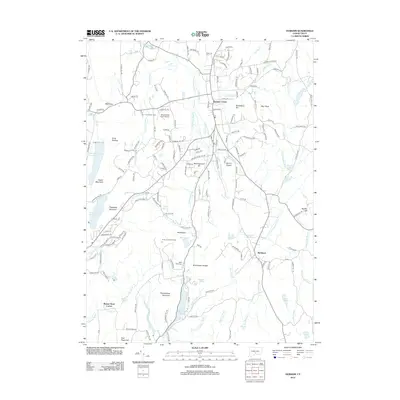
2012 Map of Durham
USGS Topo · Published 2012About this map
Durham Center serves as the central hub of this South Central Connecticut landscape, where the Coginchaug River and Allyn Brook converge near the town's primary post office. The 2012 geography reveals a mix of persistent agricultural roots and modern infrastructure, evidenced by the Linmar Dairy Farm and Maplewood Farm Airport situated just west of the main village. The terrain is defined by a series of prominent ridges and summits, including Pistapaug Mountain and Fowler Mountain to the west, and the expansive Broomstick Ledges further south.
Find a feature on this map
182 named features on this map. Tap any name to fly to it.
Don’t see what you’re looking for? This feature index may not catch every label — zoom into the map to look around manually.
Map Details
Editions of this 2012 Durham Map
This is the sole edition of this map. No revisions or reprints were ever made.
Other maps of this area

1892 · New Haven
USGS Topo · 1:62,500

1892 · Meriden
USGS Topo · 1:62,500

1893 · Guilford
USGS Topo · 1:62,500

1893 · Middletown
USGS Topo · 1:62,500

1893 · Meriden
USGS Topo · 1:62,500

1906 · Farmington
USGS Topo · 1:125,000

1921 · New Haven
USGS Topo · 1:62,500

1928 · Cromwell
USGS Topo · 1:24,000

1943 · Durham
USGS Topo · 1:25,000

1945 · Middle Haddam
USGS Topo · 1:31,680